Independence Pass


Head north 19 miles from Buena Vista (or south from Leadville) on Hwy 24. Turn west at Twin Lakes onto CO 82. Continue 23 miles to Independence Pass. Colorado 82 is a paved road all the way to Aspen, but is closed during winter months.
Aspen is 20 miles beyond Independence Pass. We spent an hour in Aspen and discovered that gas was $1/gallon higher than the rest of the state. Need to go back when we have more time to stay there all day.
Leadville
Located 35 miles north of Buena Vista (or 15 miles north of Twin Lakes/CO 82). Leadville (pop 2600) is the highest incorporated city in the United States at an elevation of 10,152ft.
Area Attractions:
Leadville Colorado & Southern Railroad
http://www.leadville-train.comSeveral museums
Downtown Historic District
Tabor Opera House
Delaware Hotel
Turquoise Lake is located minutes west of town and has a scenic drive all the way around it.
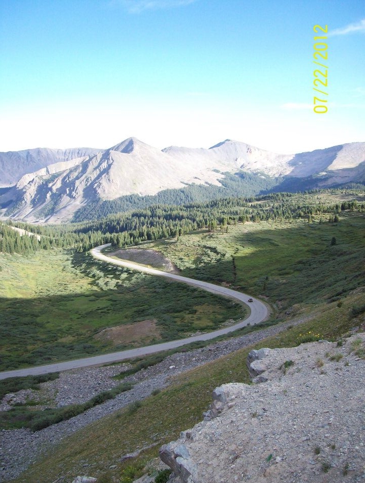
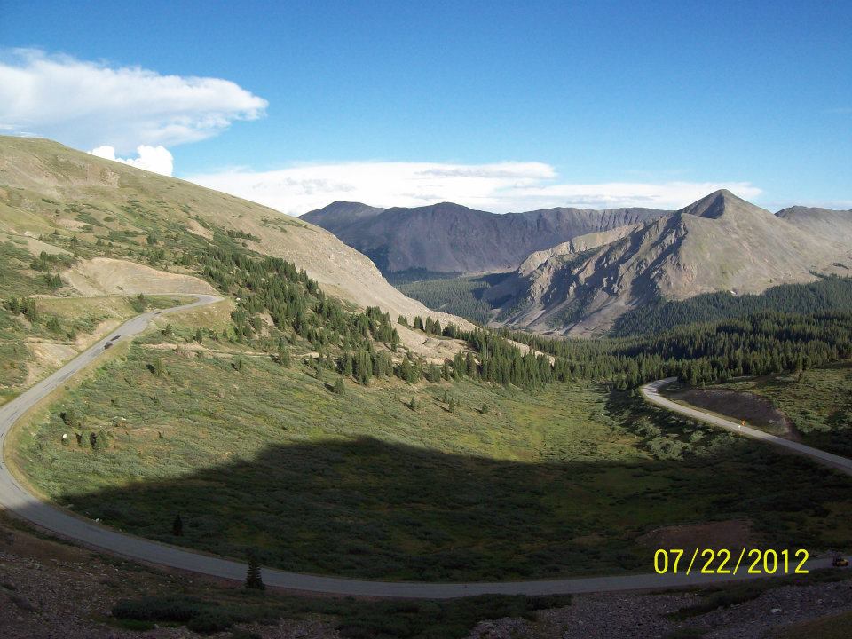
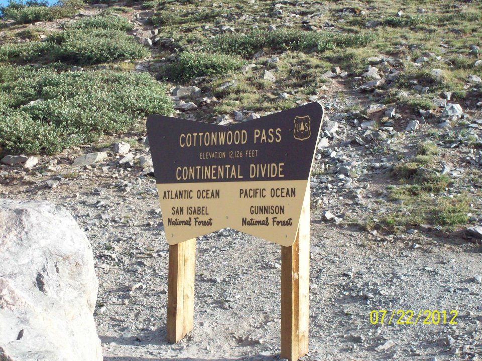
Cottonwood Pass
Cottonwood Pass is open 6-7 months of the year. From Buena Vista, take Chaffee County Road 306 west for roughly 19 miles. At the summit, the road changes to Gunnison County Road 209. By continuing on Co Rd 209, you will reach Taylor Park. If you are headed to Taylor Park in the summer months, you can avoid adding 100+ miles to your trip by taking Co Rd 209. versus taking Hwy 50 over Monarch Pass.
Take a side trip to Cottonwood Lake via Chaffee County Rd 344.

Midland Railroad Tunnels
Located just north of Buena Vista on Chaffee County Road 371. Follow Colorado Street north out of downtown and it will turn into Co Rd 371 before crossing the Arkansas River. Once on the east side of the river, Co Rd 371 follows the old railroad grade thru the series of tunnels.
Chalk Creek Canyon
Chaffee County Road 162 west of Nathrop will lead you through Chalk Creek Canyon and into the historic town of St. Elmo.
Here are just a few of the things to do in the area:

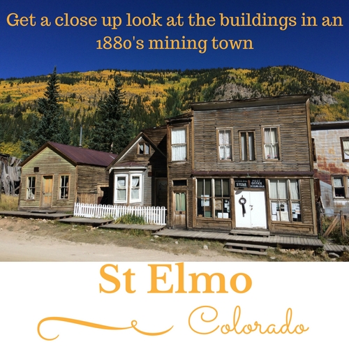
St Elmo - Colorado's most original ghost town
Cascade Falls - There is a parking area on the north side of the road. Stop at least once on your trip to enjoy the waterfalls.
The Narrow Gauge Hiking Trail & Cascade Creek Trail - These are two of the easier hikes in the area. Click here for more hiking information.
St Elmo - A mostly original 1880's Mining Town is at the end of Co Rd 162. Check out the old buildings, but remember they are all private property. Be sure to visit the General Store for some chipmunk food. More info and links to our photo tour here.
Mt Princeton Hot Springs - Get a day pass to soak in the hot springs or swim in the pools.
Jeep & ATV Trails - There are hundreds of miles of off road trails that can be accessed from Chalk Creek Canyon. One of our favorite trips is the Miner's Run loop. The 65+ mile trip crosses the continental divide twice and passes thru many historical mining camps and towns.
Camping - Some of our favorite campgrounds are located along Co Rd 162


Tenderfoot Mountain, Spiral Drive, “S” Mountain
Call it whichever you want. S Mountain is a scenic overlook east of the Arkansas River in downtown Salida. The overlook has an amazing view of the entire town and part of the Arkansas River Valley. See map below for driving directions. In addition to Spiral Drive, there is also a hiking trail from the downtown parking lot. Double check your GPS once you cross the Arkansas River. It may not take you all the way to the final turn off for Spiral Drive.
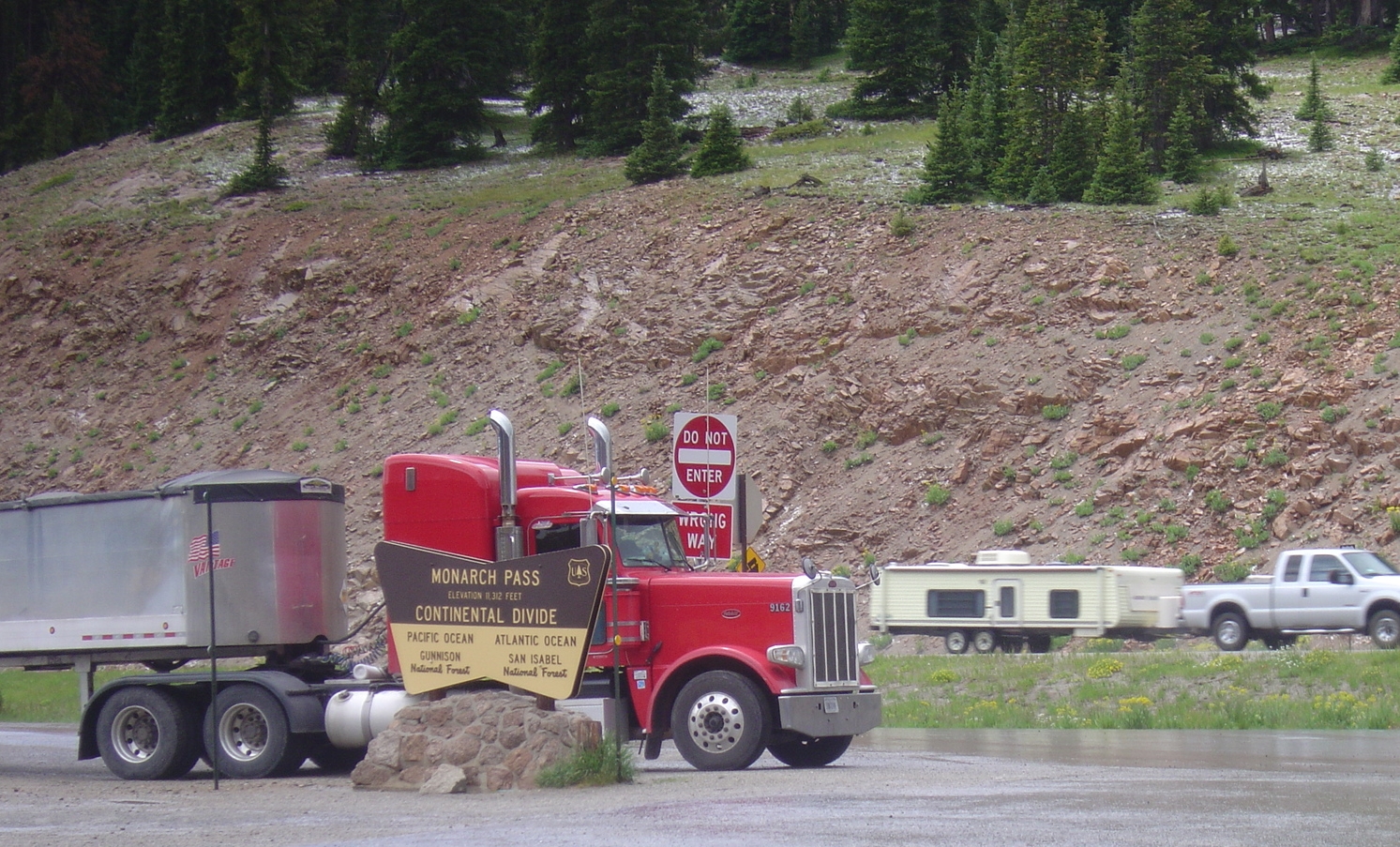
Monarch Pass
At an elevation of 11,312 feet, Monarch Pass is located at the top of the Continental Divide on Hwy 50. It is a quick 20 minutes west of Salida. (Halfway to Gunnison)
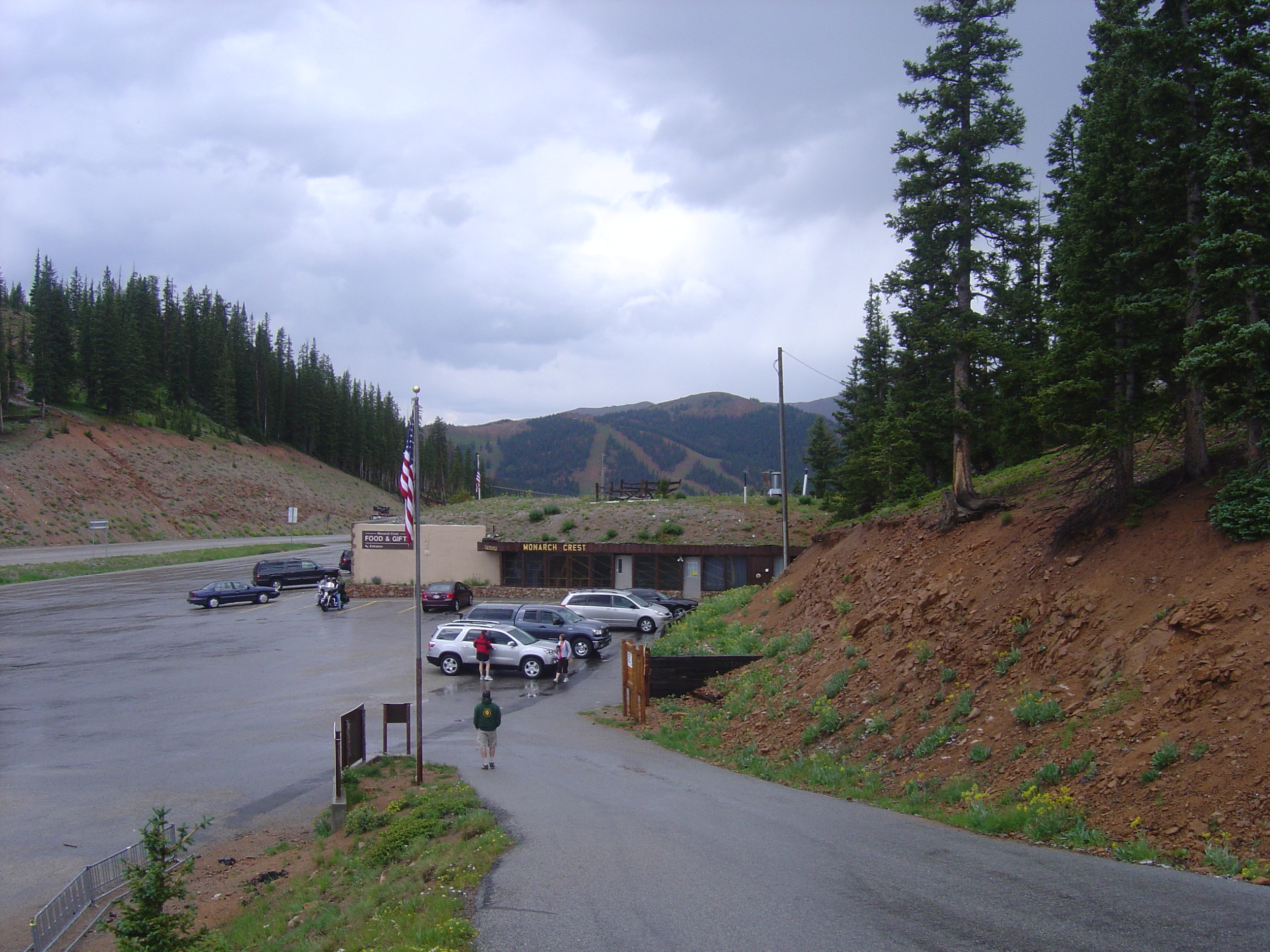
Once at the top, a tram takes passengers from Monarch pass to an elevation of 12,012 feet, for panoramic views of the Rocky Mountains in all directions.
There is also a large gift shop and concessions.
(Closed in winter months. See photos below.)
The Continental Divide Trail can be accessed just above the tram building


San Luis Valley
Take a day trip to the San Luis Valley. Head over Poncha Pass on Hwy 285 south of Salida.
San Luis Valley is a 100+ mile long, flat valley known for agriculture, UFO sightings, and the sand dunes. Ag products include potatoes, lettuce, carrots, & spinach. Alamosa (pop 10,000) is located about an hour drive towards the south end of the valley.
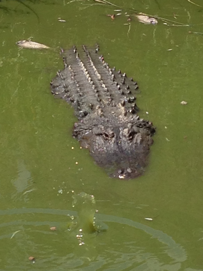
Feeding the alligators at Colorado Gators
Attractions include:
Great Sand Dunes National Park
http://www.nps.gov/grsa/index.htmColorado Gators - Feed alligators, hold a small gator, or learn to wrestle alligators in this unique Colorado attraction.
http://www.coloradogators.comUFO Watchtower - Watch for aliens
http://www.ufowatchtower.comRio Grande Scenic Railroad - Take an all day train ride from Alamosa to LaVeta and back.
https://www.coloradotrain.comCumbres & Toltec Scenic Railroad - Located 30 miles south of Alamosa in the town of Antonito. This all day train ride that will take you across the New Mexico border several times.
http://cumbrestoltec.com