Taylor River Campgrounds
US Forrest Service campgrounds along the Taylor River and Gunnison County Rd 742 include One Mile, North Bank, Rosy Lane, Lodgepole, Cold Spring, Lottis Creek, & Lakeview. Last minute supplies are available in Almont at Three Rivers Resort General Store or 23 miles up County Rd 742 at the Taylor Park Trading Post.
Campsites that accept reservations may be reserved up to 6 months in advance at www.reserveamerica.com
North Bank Campground
North Bank Campground is located just over 7 miles from Almont Colorado at an elevation of 8600ft. Several of the 16 campsites are adjacent to the Taylor River and the Doctor Park Trailhead is located at the end of the campground. There is no cell signal with AT&T but the last 2 summers we noticed a great improvement with Verizon in multiple locations along the Taylor River that had no service the prior year. You may need to travel a short distance to get signal. North Bank campground is usually open from mid-May to late-September. South Bank river access is available near the entrance to the campground.
One Mile Campground
Located at an elevation of 8600 feet, One Mile Campground is ideal for larger RV's. The in and out road is paved all the way thru camp with plenty of room in the turn-around at the end. Electrical hookups are available and Verizon customers will have cell service. AT&T service is poor along most of the Taylor River. The campground is located just across the road from the Taylor River.
Rosy Lane Campground
Sites 1-2 & 15-19 are near Gunnison County Rd 742, but there are few cars after 10pm.
Site 3 is a walk-up site and can't be reserved. It has a path to the river and has more trees than site 1 or 2. We have stayed at sites 2 & 3 and definitely would stay at site 3 again.
Camping Facilities:
Taylor River at Rosy Lane Campground (Behind Campsite #3)
Elevation 8600 feet.
19 Camp Sites
Picnic Tables
Fire Rings
Firewood available for purchase from Camp Host
Modern Vault Toilets
Water - 1 Hand Pump located near toilets
Trash Bins
2016 - Cell signal is good for Verizon users. No signal for AT&T.
Lodgepole Campground
Lodgepole has 3 entrances off of County Rd 742. First entrance is for sites 1-9, the camp host, and the good outhouse built in the early 2000's. The second and third entrances are a loop past sites 10-15 and the 1950's outhouse. There is a trail connecting the two areas of the campground. Outhouse design has improved since the 1950's. Walk to the new toilet if you are at sites 10-15.
We pitched our tent next to a big boulder in campsite #10 for a night in July. It is on the list of places we will definitely camp again.
The Taylor River is located across the road and there is a large parking area by the river for fishing access.
Lodgepole - Middle Entrance (Site #10 in background)
Campsite #10 Lodgepole Campground - Gunnison County
Camping Facilities:
Elevation about 9000 feet.
15 Camp Sites
Picnic Tables
Fire Rings
Firewood available for purchase from Camp Host
1 - Modern Vault Toilet near the center & 2 - 1950's Outhouses on either end.
Water - 1 Hand Pump located near Camp Host
Trash Bins
Cold Spring Campground
Located about 15 miles up Taylor River Road (Gunnison Co Rd 742), this rustic campground is made up of 6 campsites and 1 older outhouse. Water is not available at this campground. No trailers allowed. As of 2016, the fee is $10/night.
Lottis Creek Campground
Lottis Creek Campground has sites for large RVs with electrical hookups. 23 of the reservable sites have electricity.
In addition to the Lottis Creek Group Campground, there are 49 campsites in 3 loops:
Baldy Loop - 15 Sites
Union Park Loop - 23 Sites
Park Cone Loop - 11 Sites accessed from a separate entrance south of Lottis Creek.
Taylor Park Reservoir is 3 miles up the Taylor River Road and has boat rentals and supplies. An RV dump station is located in Gunnison Colorado.
Hiking near Lottis Creek Campground can be found on the South Lottis Trail near the Union Park Loop. Elevation 8600 feet.
The Fossil Ridge Wilderness Area is located 2 miles south of the campground.
Lakeview Campground - Taylor Park
At 9400 ft, Lakeview Campground has 68 campsites including almost 20 with electrical hook-ups. Situated on a hillside overlooking Taylor Park Reservoir, the terraced layout gives most campsites spectacular views of the lake and the Sawatch Range. Boat rentals and boat ramp are located just below the campground. Taylor Park Reservoir contains salmon, pike, and most types of trout. Taylor Park Trading Post is a mile down the road in case you need extra supplies. Hundreds of miles of off-road trails are close by.
**Note: There is another Lakeview Campground near Leadville/Twin Lakes in the San Isabel National Forest. Be careful when making reservations so you get the correct one.
Crested Butte Area Camping
Lake Irwin Campground
Lake Irwin is a high alpine lake on the eastern slope of the Ruby Range. The area is home to large meadows of wildflowers, hiking trails, waterfalls, fishing & canoeing. Less than 5 miles away is Kebler Pass, home of one of the largest aspen groves in the United States.
Check out the review of Lake Irwin Campground on our blog
Camping Facilities:
Elevation 10,200 feet.
GPS Info: 38°52'52"N, 107°6'25"W
Cell Service: AT&T-None. Verizon-None
26 Reserve-able Camp Sites
Picnic Tables
Fire Rings
Firewood available for purchase from Camp Host
Modern Vault Toilets
Water - Hand pump by Site #14
Trash Bins


Quartz Creek / Pitkin Area
Pitkin Campground
Located along Quartz Creek in the Gunnison National Forest about 1/2 mile east of Pitkin Colorado.
Pitkin Campground Features:
23 Campsites are First come - First served
Good cell service with Verizon and AT&T
Firewood available from Camp Host
Creek side campsites available
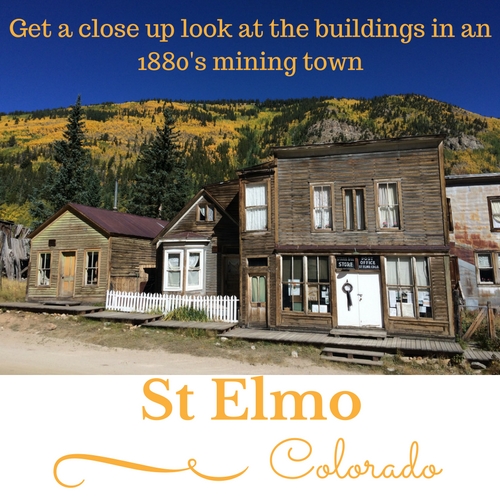
There are hundreds of miles of jeep & atv trails nearby. Traveling on the trails, you can reach Taylor Park, Tincup, St Elmo, Hancock Pass, Tomichi Pass, Cumberland Pass, Mt Antero, the Alpine Tunnel, and much more.
Middle Quartz Campground
Middle Quartz Campground consists of dispersed camping sites along Middle Quartz Creek about 6 miles east of Pitkin Colorado. With an elevation of 10,200 ft, some sites still have snow in late May.
7 Campsites
No Trash Service - Pack it out!
No Water or Cell Service
1 Outhouse
The road is rough the last couple miles to the campground.
There are plenty of dispersed camping sites along the way.
Quartz Campground
Quartz Campground is located 4 miles east of Pitkin Colorado along North Quartz Creek and the road to Cumberland Pass (FR 765). Elevation 9,800 ft. The dirt road to the campground is usually in good condition.
10 Campsites
1 Outhouse
Water
Curecanti National Recreation Area
Blue Mesa Reservoir, Morrow Point Reservoir, & Crystal Reservoir are the 3 lakes formed by dams on the Gunnison River that make up the Curecanti National Rec Area. There are numerous campgrounds along the lakes with easy access from US Hwy 50.
Lake Fork Campground
Located near the dam on Blue Mesa Reservoir.
90 Campsites. (No reservations for Lower Level)
Good Cell Phone Service
Pay Showers
Flush Toilets
Boat Ramp and inspection station is part of the campground.
Map: http://www.nps.gov/cure/planyourvisit/upload/Lake-Fork-Campground.pdf
Red Creek - Group Campground
1 Group Site
1 Individual Site - First come - First served
Limited turnaround for RV's - 22ft limit
Elk Creek Campground
Located along Blue Mesa Reservoir 16 Miles west of Gunnison. Just off Highway 50.
160 Campsites
Reservations accepted for Loops A & D. Must be made at least 3 days in advance.
Electricity in Loop D only. Reservations highly recommended during summer months
Pay Showers
Dump Station
Boat Ramp
Map: http://www.nps.gov/cure/planyourvisit/upload/CURE_elk_creek_campground.pdf
East Elk Creek - Group Campground
1 Group Site can accommodate up to 50 people in tents or RVs.
Stevens Creek Campground
12 Miles west of Gunnison along Hwy 50.
53 Campsites
Reservations accepted for Loop A only (Make at least 3 days in advance)
Boat Ramp
Fish Cleaning Station
Water Station
Accessible campsites
Map: http://www.nps.gov/cure/planyourvisit/upload/Stevens-Creek-Campground.pdf
Dry Gulch Campground
17 Miles west of Gunnison and just north of Hwy 50.
The 9 Campsites are First Come - First Served
Tents or Medium Size RV's
Horse Corral
Water Station
Vault Toilets
Gateview Campground
Due to narrow gravel road, it is recommended that use be limited to tent camping only.
6 Campsites are First Come - First Served
Vault Toilets
Water
Ponderosa Campground
Located at the northwest end of the Soap Creek Arm of Blue Mesa Reservoir
The 28 Campsites are First Come - First Served
Tents or Medium Size RV's
Horse Corral
Water Station
Vault Toilets
Boat Ramp
Cimarron Campground
Located 20 miles east of Montrose off of Hwy 50. Crystal Reservoir is about 1.5 miles from the campground.
The 21 Campsites are First Come - First Served
Water Station
Vault Toilets
Dump Station
East Portal Campground
Located at the bottom of the Black Canyon about 2 miles downstream from the Crystal Dam. RV's are limited to 22 ft or less due to the winding, 16% grade down hill to the campground.
16 Campsites are First Come - First Served
Water Station
Vault Toilets
Boat-In Camp Sites
There are several boat-in campsites in the Curecanti National Rec Area.
For more info - https://www.nps.gov/cure/planyourvisit/boatincamping.htm