Know Before You Go...
ATV Rentals
Pitkin - Silver Plume General Store
Taylor Park - Taylor Park Trading Post
Buena Vista - BV Jeeps
Jeep Rentals in Chaffee County
Salida - Rocky Mountain Jeep Rentals
Buena Vista - BV Jeeps
OHV License - If you bring your own ATV, you will need an OHV (Off Highway Vehicle) registration from your home state. If your state does not require registration, you may purchase an out of state permit anywhere that Colorado hunting & fishing licenses are sold. For more info visit http://cpw.state.co.us
What to wear for a mountain ATV ride
Eye Protection - Sunglasses or prescription glasses will protect you somewhat, but it won't stop the dust. Goggles are recommended
Bandanna or some type of face covering. Keeps your face warm in the morning and keeps the dust out on the dustier sections of the trail.
Layers - Morning temperatures can be in the low 40's even in July/August. Sunny afternoons can be around 80 but feels warmer at higher elevations. We have rode in sleet and snow during July and then an hour later been wearing a t-shirt. Be prepared for all types of weather.
Raincoat - Cheap rain gear from a local sporting goods store will be handy if afternoon showers arrive.
Helmet - Not required by law, but highly recommended. Required on all ATV rentals.
Food & Water - Be sure to take plenty of water and some food. You can become dehydrated quickly at high elevations.
Gas - Available in Pitkin at the Silver Plume General Store http://silverplumegeneralstore.com or at Taylor Park Trading Post http://www.taylorparktradingpost.com
Miner's Run - Tincup Pass - Hancock Pass - Cumberland Pass
The Miner's Run Loop is one of the most popular off-road vehicle trails in Central Colorado. While crossing the continental divide twice, the trail follows along old railroad grades, through historic mining towns, and passes abandoned mines.
Miner's Run Map. Actual distance is closer to 65 miles if you take the side trips to Mary Murphy Mill and the Alpine Tunnel which are both highly recommended.
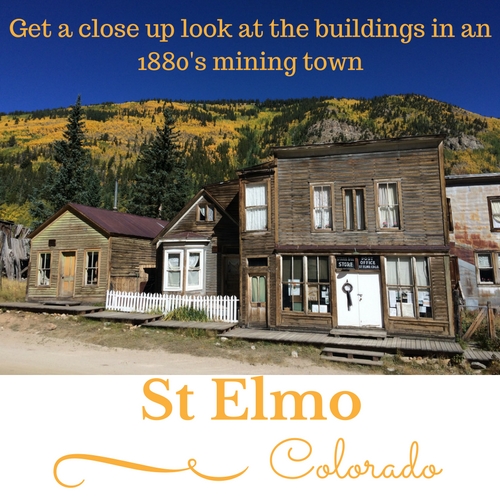
We have traveled the loop several times, always beginning in St Elmo. Due to one steep spot on the south side of Hancock Pass, we have found it easier to head south and go down the incline instead of taking the opposite route.
Directions:
Choose from 3 starting points when traveling the Miner's Run Loop: St Elmo, Pitkin, or Taylor Park. The information below was put together when you could still rent ATV's in St Elmo.
St Elmo - The starting point for the day is less than a quarter mile from St Elmo at the beginning of Forest Road 295. (Halfway between the large parking area on Chaffee Co 162 and St Elmo) You may want to take advantage of the outhouse at the parking area.
FR 295 is accessible by car all the way to the former town of Hancock, but it becomes bumpier as you get closer to Hancock.
Mary Murphy Side Trip - 38°40'23.4"N 106°22'00.0"W -
Requires four wheel drive.
From Forest Rd 295 take a left onto FR 297 towards the Mary Murphy Mine. The Mary Murphy Mill & Bunkhouse are located almost a mile down FR 297. The trail becomes steep and rocky not much further from this point. If you don't have time to continue up to the actual mine, return back to the start of FR 297, then continue back south on FR 295 to Hancock. If you have time to continue, the trail leads to the Mary Murphy Mine and Pomery Lake.
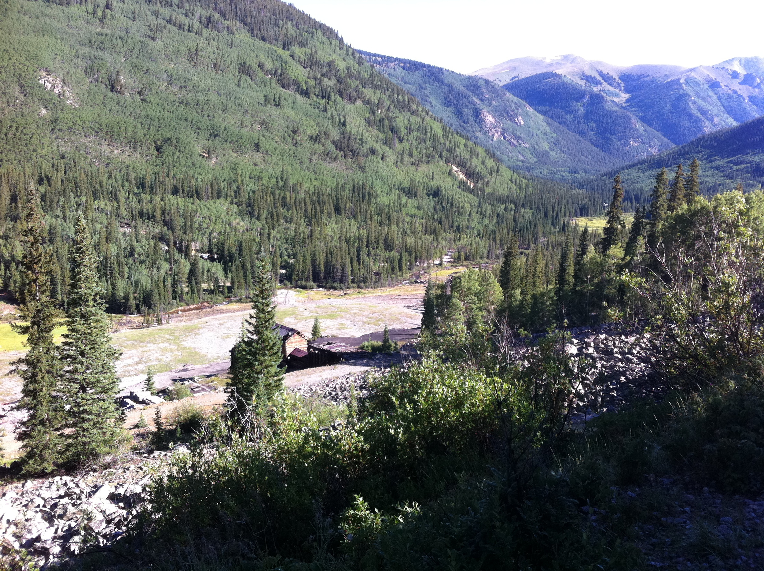
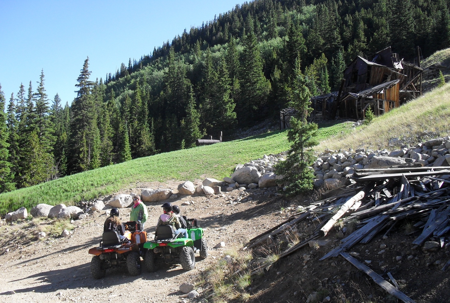
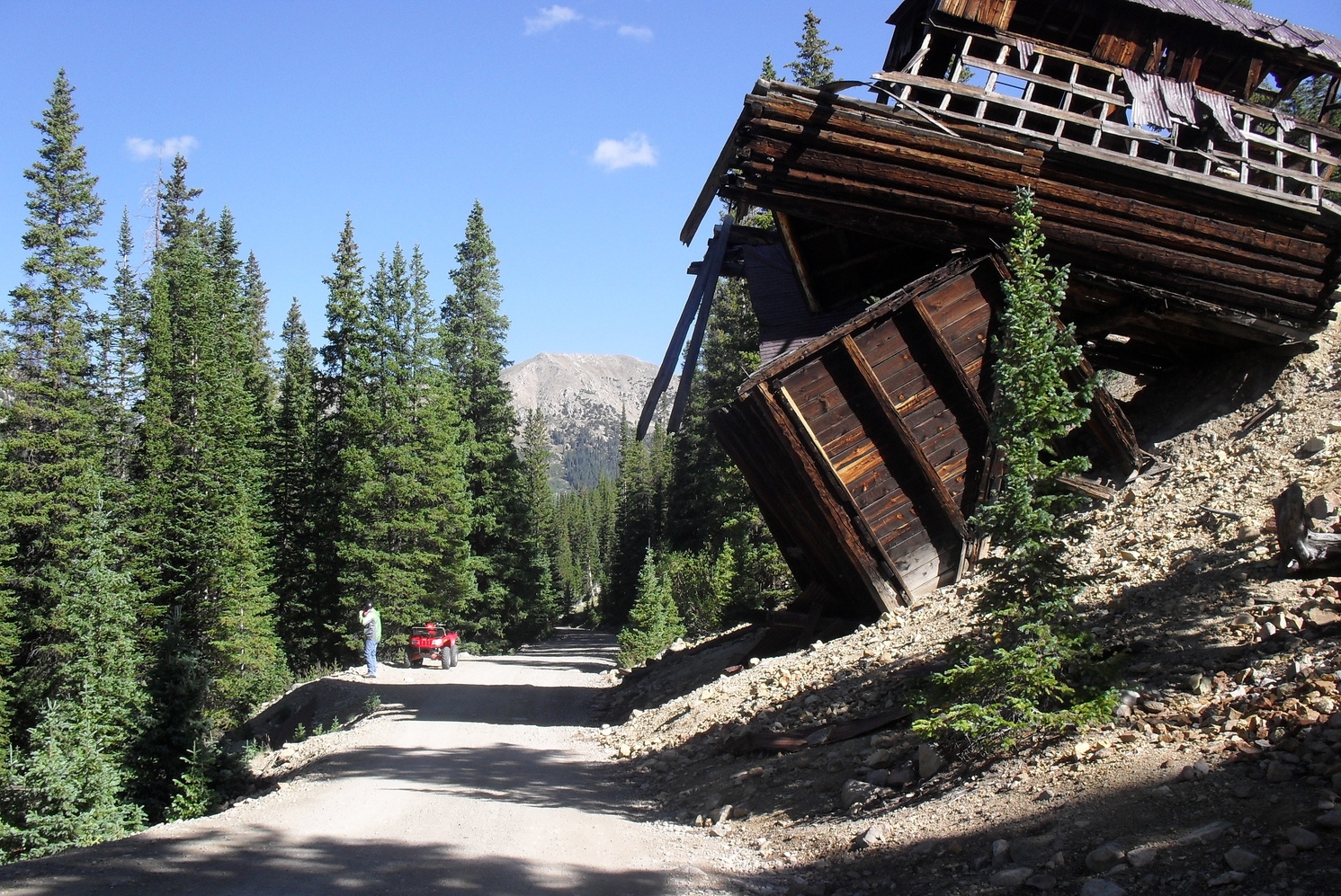
Allie Belle Mine - Ore Tipple - One of the most photographed locations along Chaffee County Rd 295. For years the tipple has looked like it could crash onto the road any day.


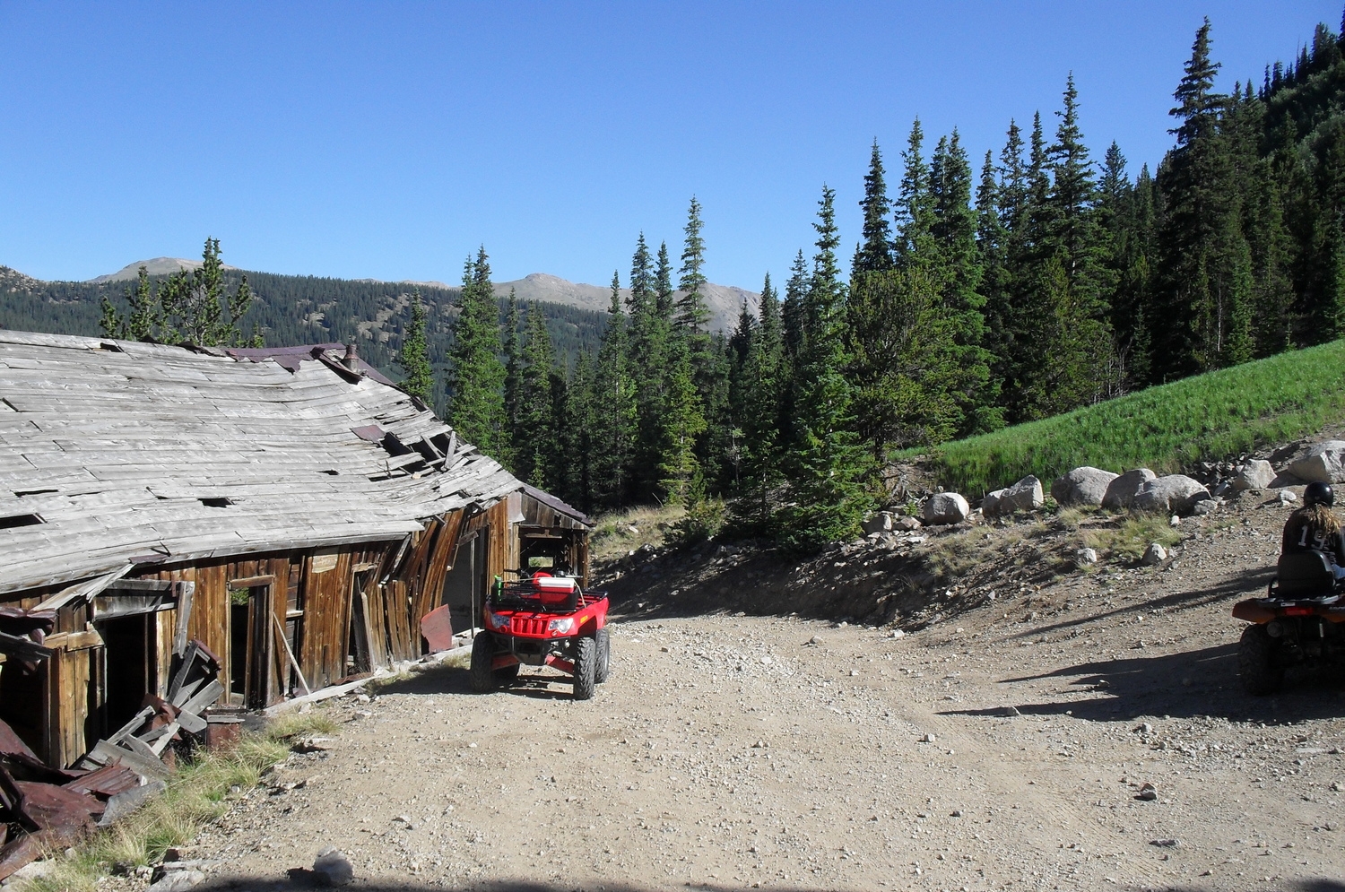
Hancock - Arrive approximately one hour into the ride. Not much remains except several signs and the lower portion of a couple buildings. The first right turn leads to hiking trails and the north entrance to Alpine Tunnel. At the 2nd right turn, take FR 299 to Hancock Pass. 4WD is required the entire length of 299.
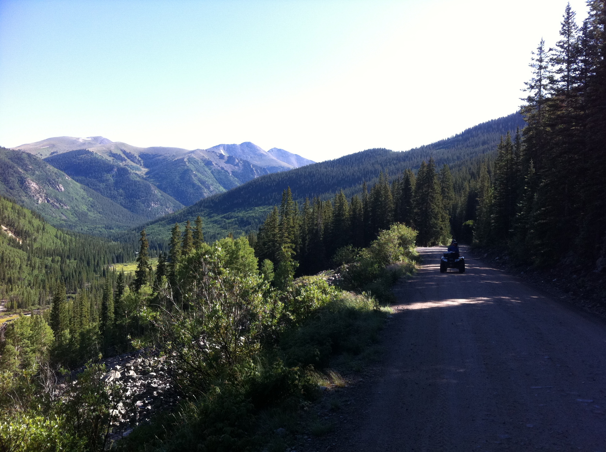
Hancock Pass (Elevation 12,140ft) - From here you will be able to see the trail to Tomichi Pass across the valley to the south. Begin your descent on FR 266.
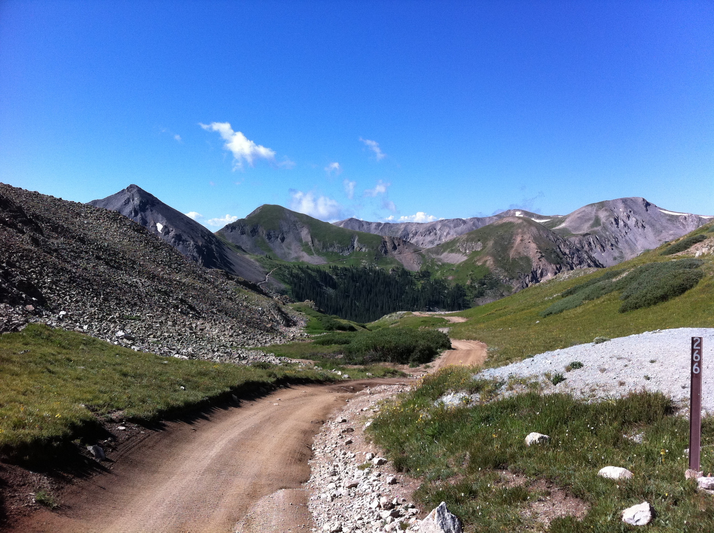


When FR 266 intersects with FR 888, you will want to go right. Going left (east) will take you to Tomichi Pass.
Continue west (right) on FR 888 until it connects to FR 839 near the Sherrod Loop Site. GPS Coordinates: (38.613628, -106.389987)
Make a right turn for the side trip to Alpine Tunnel, left turn leads to Pitkin. The road isn't very rocky from this point until reaching Mirror Lake later in the day.
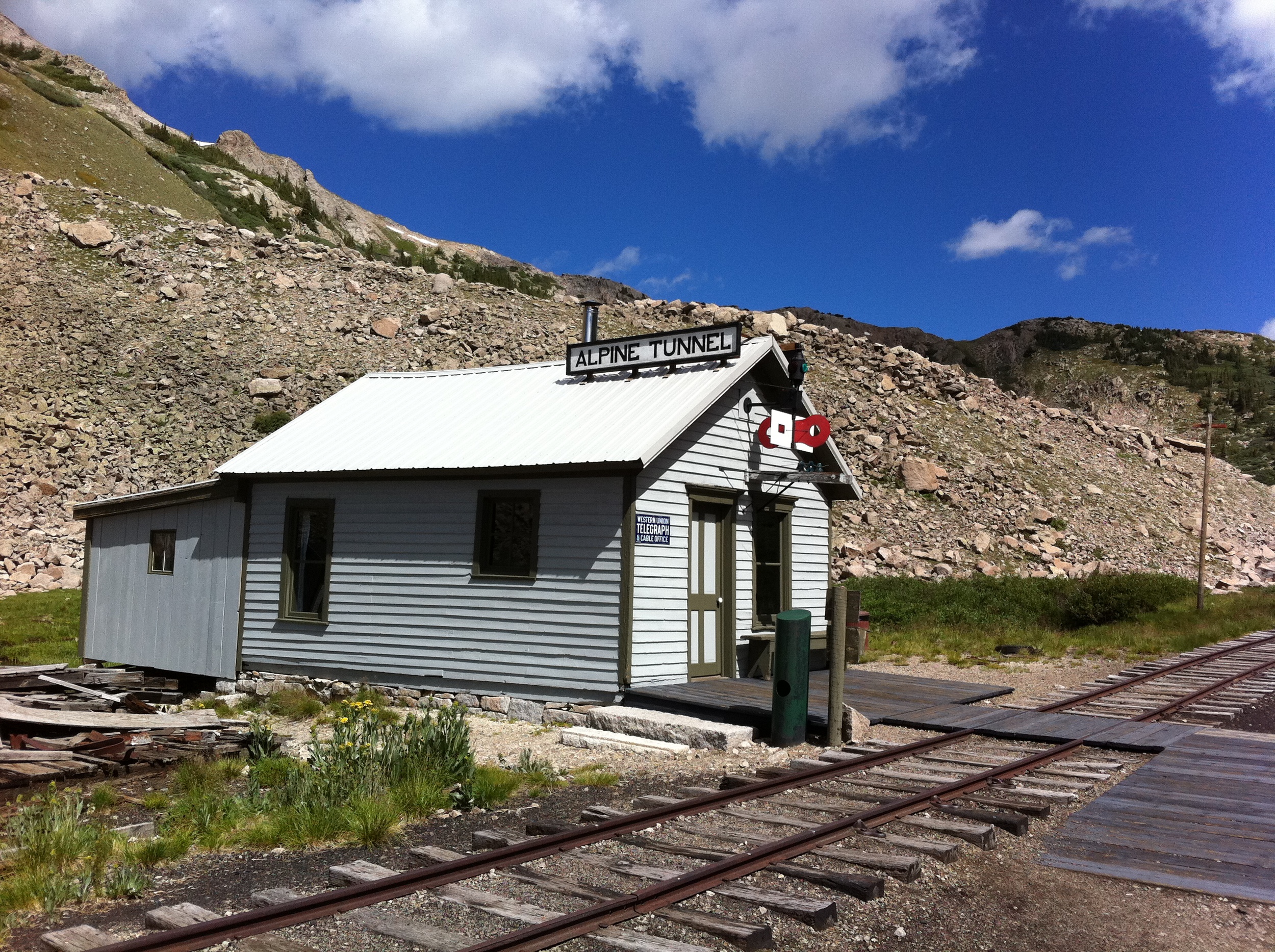
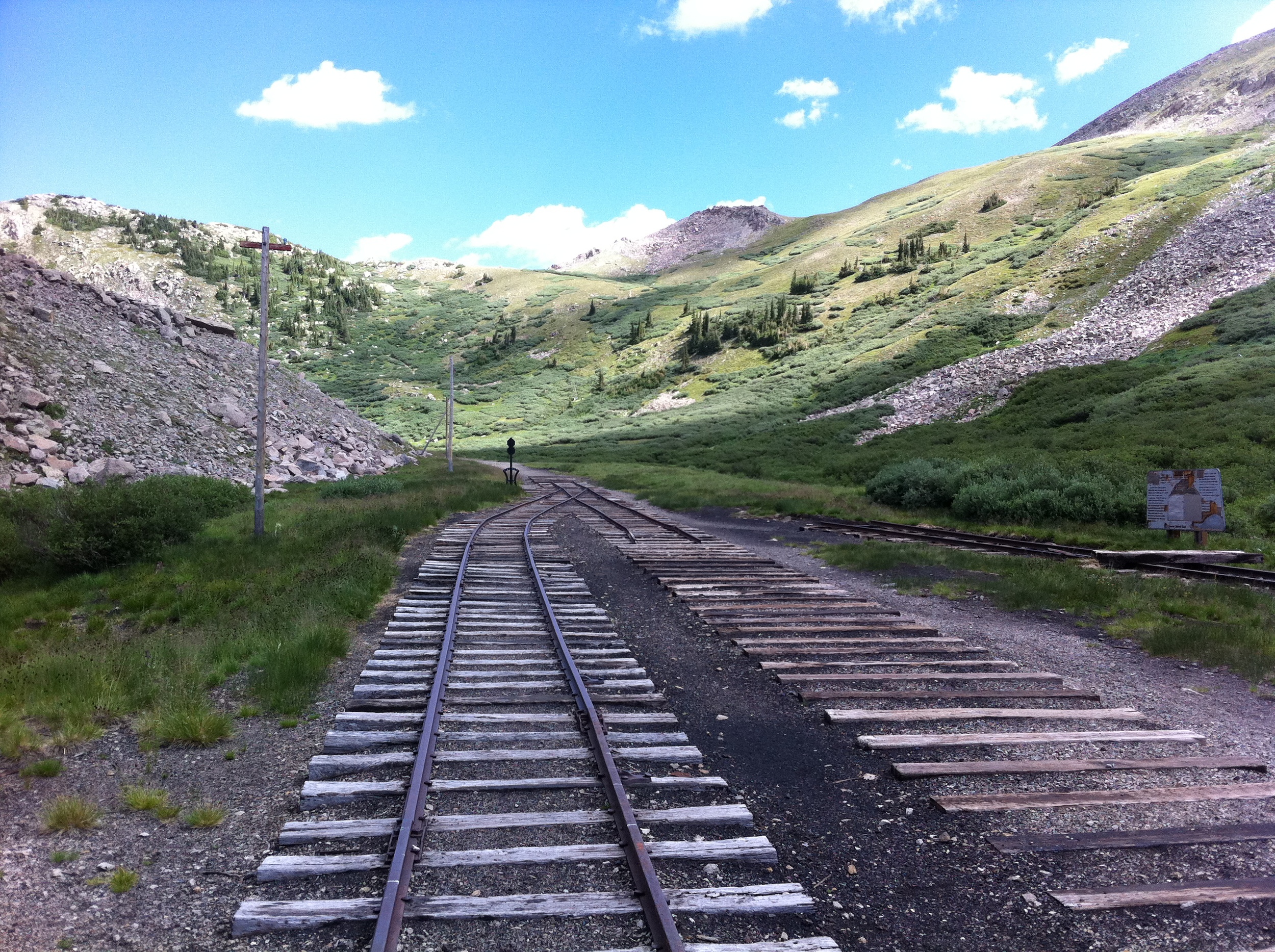
Alpine Tunnel - The side trip to Alpine Tunnel is 2.3 miles each way. You will cross over the narrow man-made terrace known as the "Palisades" about halfway to the Alpine Station. The parking area is about a mile walk from the collapsed Alpine Tunnel. If you are short on time, avoid the last half mile of the trail. The collapsed tunnel entrance is hidden around a curve, and isn't too impressive. You would be better off spending your time checking out the old railroad buildings and reading the signs.


Back at the intersection of FR 888 & FR 839, head west (right) on 839 for 5.7 miles. FR 839 follows the old railroad grade and you will pass several restored water tanks from the railroad. Down in the valley to the south you will see Middle Quartz Creek. FR 839 connects to FR 765 about 2.6 miles north of Pitkin.
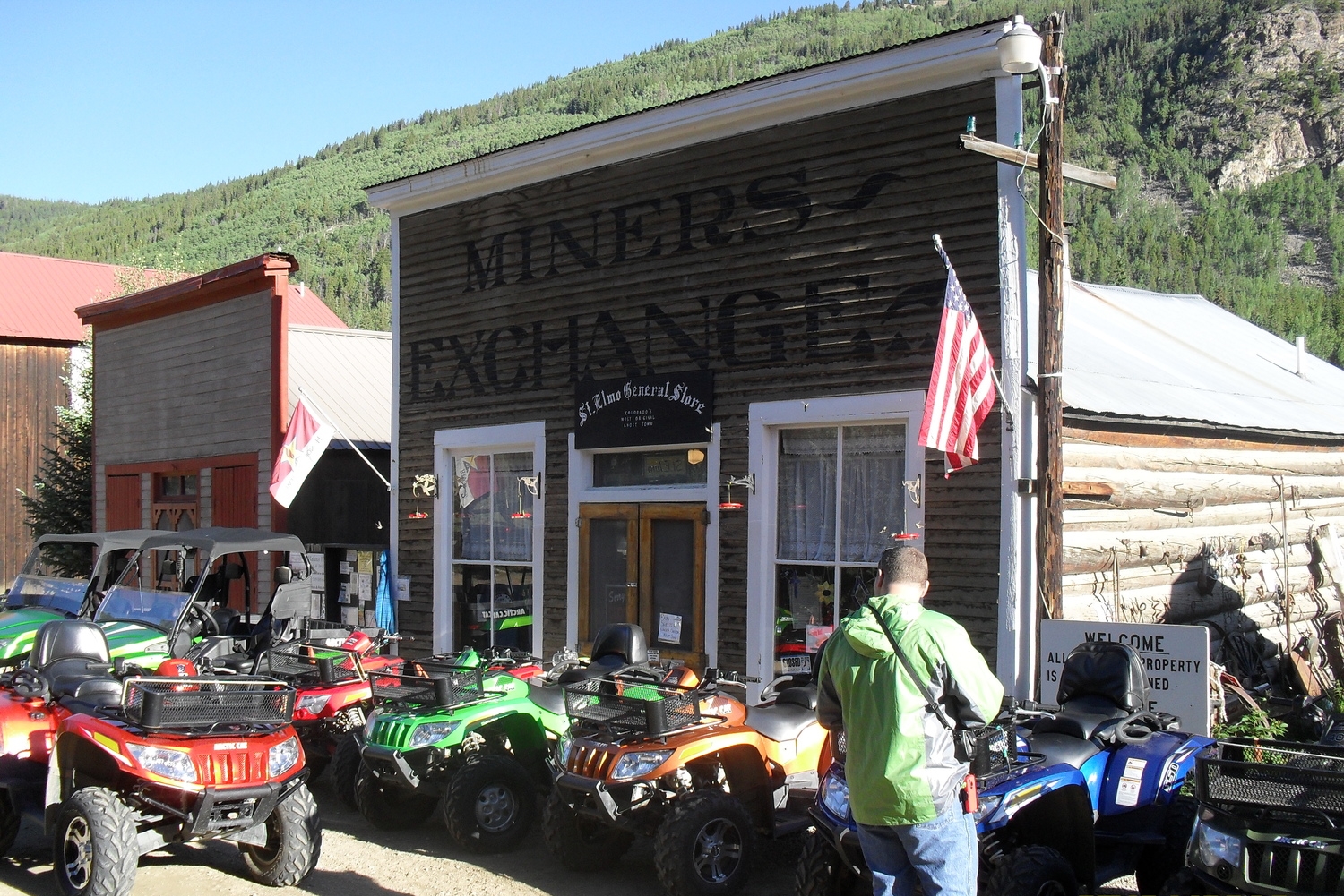
Gas is available at the Silver Plume General Store in the town of Pitkin. The general store also has ice cream, snacks, and cold drinks. You can get a great burger next door at the Silver Plume Grill. A valid driver's license is required to ride in this ATV friendly town.
From Pitkin head back north 2.6 miles to the intersection of 765 & 839.
Continue north on 765 for another 8.2 miles to Cumberland Pass (12,015 ft). You will pass a number of old mines along the way.


Tincup is located 8.6 miles north of Cumberland Pass on 765. Just south of town is 765.2A, which leads to Tincup Cemetery. The cemetery is worth the side trip if you have never been.
In Tincup you can get a good burger or a Tincup Pie at Frenchy's Cafe. The ATV ride to St. Elmo is 2-2.5 Hours.


From the center of Tincup take FR 267 east 3.5 miles to Mirror Lake. The trail becomes rocky along the east edge of the lake, then crosses the creek on the south edge. The uphill climb begins here. 1.9 miles up the trail you will need to look for the trail to make a hard right. Going straight will take you on Old Tincup Pass, which is very difficult. Tincup Pass is another mile and a half. Tincup Pass rarely opens before the first week of July due to the snow. St Elmo is another 6 miles down FR 267.